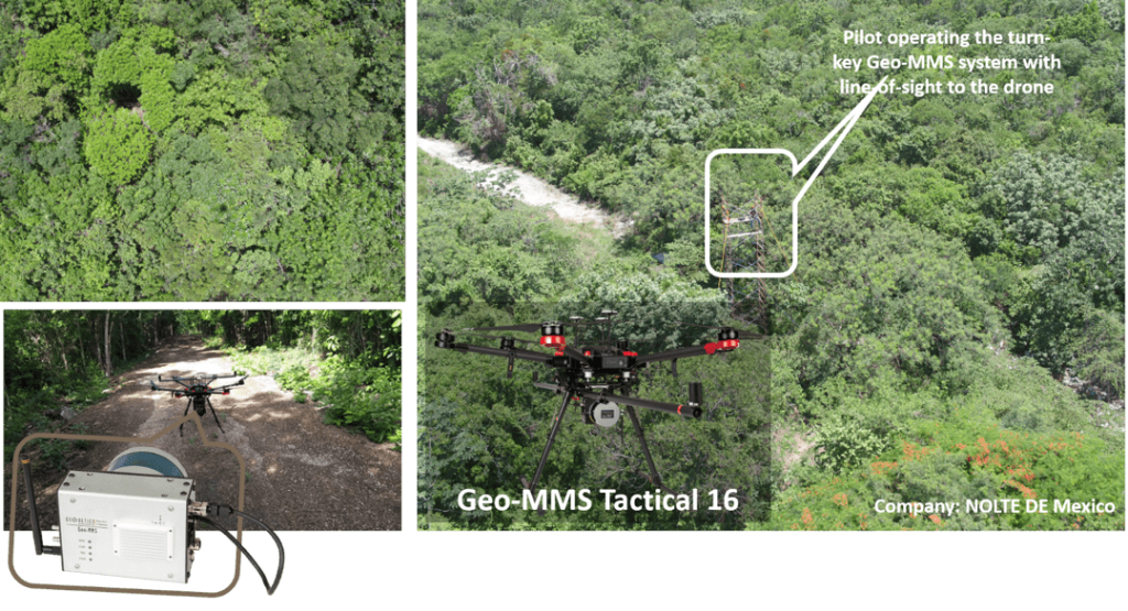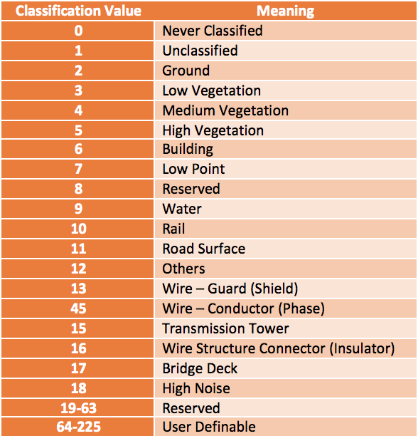


Geo-MMS Used for Railway Drone Inspection
Railway Drones: UAV-LiDAR Applications There has been a growing consensus globally regarding the importance of public transport, including a revival of rail for both public and freight transport after having long been neglected throughout much of the 20th century. When nations developed impressive rail networks, many of them became obsolete as the global population became …